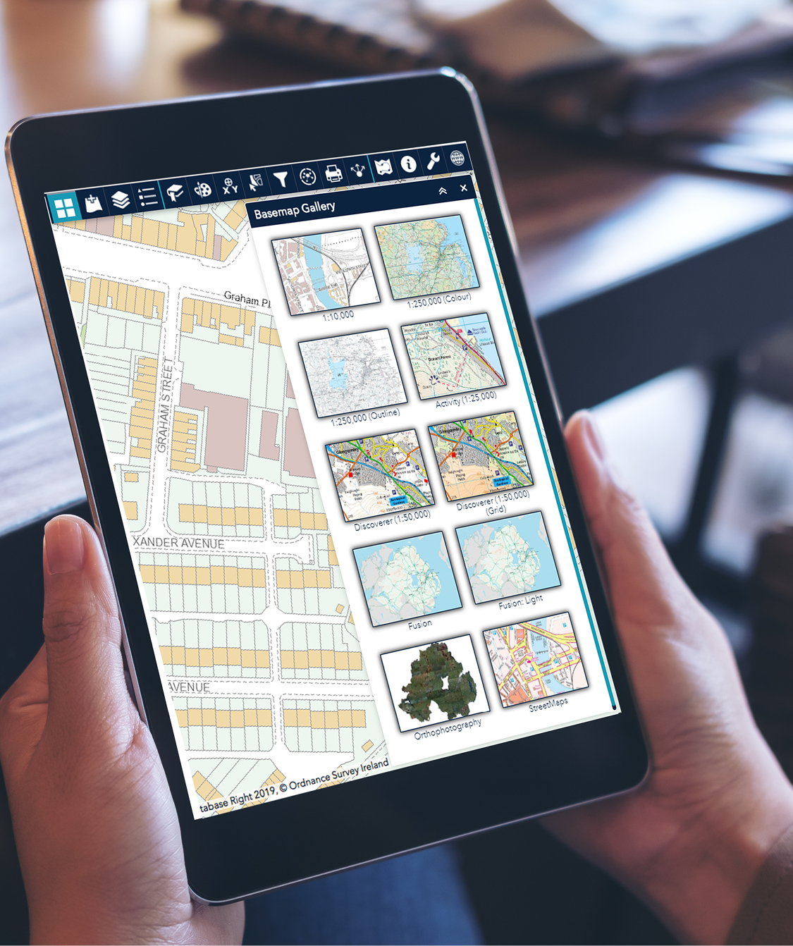
Basemaps
Choose from either the authoritative OSNI basemap or aerial imagery as a background basemap.
Visualise
Our map viewer makes it easy to view data from multiple sources. Search our catalogue, view the items metadata and add content to the map.
Display
Switch on and off layers or rearrange them in the layer list for a clearer perspective. Adjustable layer transparency gives you more control over what you see.
Navigate
Quickly locate your area on the map by searching for an address and navigate the map by zooming and panning around. An overview map is also included to help you visualise your location.
Query
Click on a feature from an added dataset to discover the information held for that geographic location. Information might include things like the townland name or address for a property.
Quickly and easily print your map to a PDF document using one of our predefined A4 styled templates.
Draw/Measure
Easily annotate your map and save these locally or share with others. Select the measurement option including your units to obtain the length and area for features.
Location
Easily obtain the Irish Grid coordinates for a location on the map by using our coordinate finder widget.